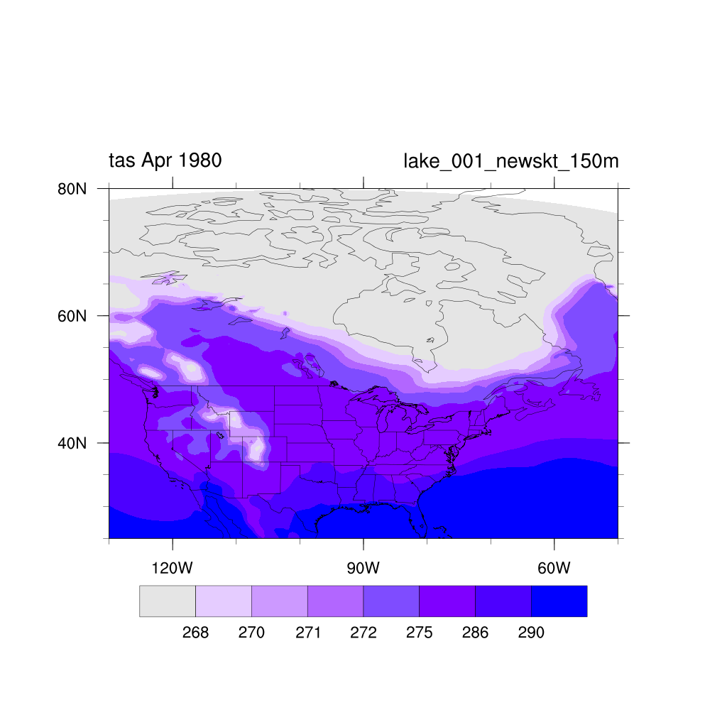
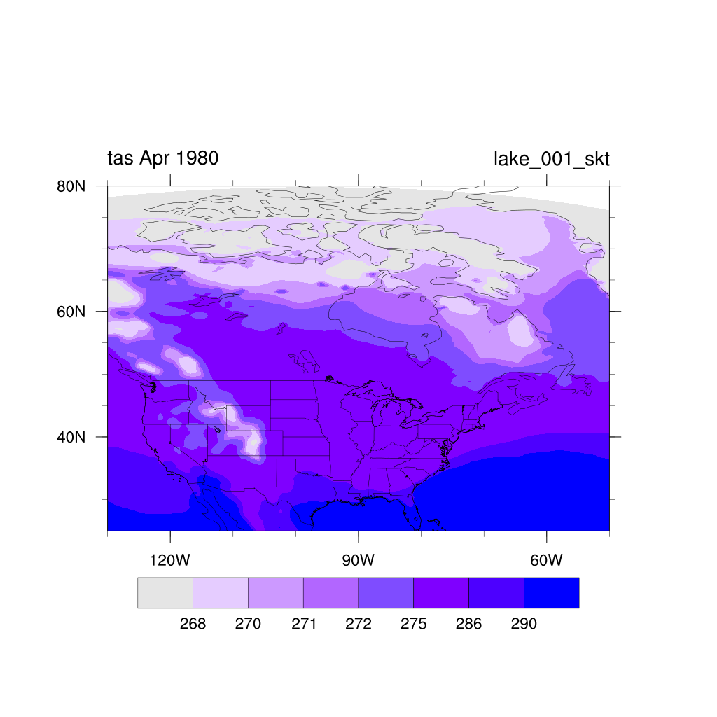
The RegCM4 runs with ERA-Interim boundary conditions performed for the North America CORDEX domain use sea surface temperature over all ocean points. A plot of monthly mean surfade temperature for April 1980, which is when ice cover in Hudson Bay and James Bay is near maximum, shows that temperatures over these water bodies are too warm. (Note the irregular contour interval, which focuses on temperature around the freezing point of sea water. The colors used for shading are unattractive but help to distinguish contour levels.)
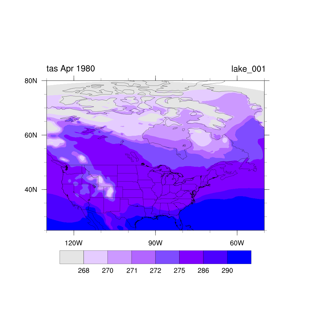
Temperatures are in the range 272-275 K over James Bay, and 270-272 K over Hudson Bay and the waters between the Arctic islands. This is much warmer than expected during the period when these regions are ice covered.
Inspection of the RegCM4 subroutine for reading ERA-Interim sea surface temperature
showed that the code includes an option for using skin temperature instead of sea
surface temperature. This is activated by setting namelist variable
File name Dates tskinERAIN.1979-1989.nc 00 UTC 1 January 1979 - 18 UTC 31 December 1988 tskinERAIN.1989-2009.nc 00 UTC 1 January 1989 - 18 UTC 31 December 2008 tskinERAIN.2009-present.nc 00 UTC 1 January 2009 and later
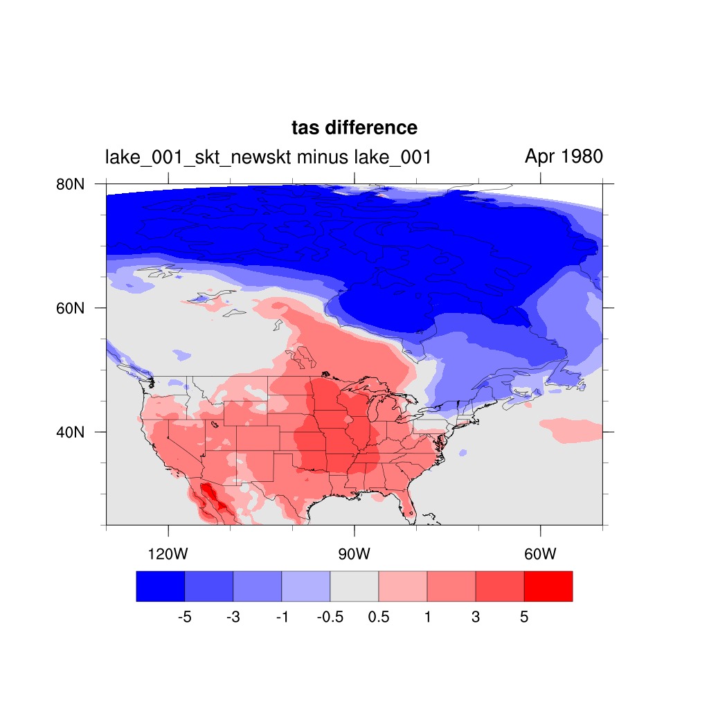
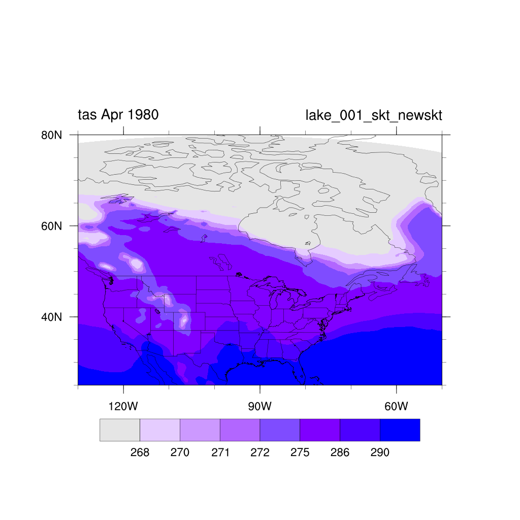
The test was redone using ERA-Interim skin temperature instead of SST for the lower boundary. The changes were surprisingly small, with temperatures over Hudson Bay and the Arctic still being too warm as shown in the figures (run with skin temperature is on the left; run with SST shown again on the right for comparison).
Close study of the RegCM4 input routine for SST showed the following lines of code:
! Respect convention for ice
if ( sst(i,j) < 271.5D0 ) sst(i,j) = 271.0D0
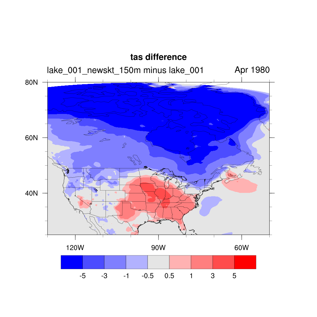
This limits the resulting SST in RegCM4 to no lower than 271 K. I changed the code so that this restriction is used only when SST rather than skin temperature is used as the input variable, and redid the test run. Results for the run with modified code are shown on the left and the original run is again shown on the right for comparison.
The differences are easier to see in a plot of the difference field for near-surface air temperature (modified run minus original)
as shown below. The colder temperatures over Hudson Bay and the Canadian Arctic are readily apparent. It is also interesting to
note that temperatures over much of the continental U.S. are 1 to 3 K warmer. Perhaps this results in part from a dynamical response
to the much colder temperatures (and thus altered pressure field) over the northern part of the domain.
Internal variability of the model could also play a role.
A close look at the temperature difference field shows the Gulf of California is much warmer thank in the original run. The SST input data contains missing-value flags for land points but the skin temperature data do not; i.e., the skin temperature data include values for both land and water points. Therefore the Gulf of California (which is poorly resolved in the 1.5-degree ERA-Interim data) could be using land skin temperatures. Therefore I processed the ERA-Interim skin temperature data so that it included missing-value flags at the same points as the ERA-Interim SST data. The result should be a data set that has valid (non-missing) entries at the same point as the SST data. Redoing the simulation produced the temperature field (left) and difference field (right) shown below. The difference field is again calculated by subtracting the original SST-driven run from the modified run.